Ragiunata
Ponds, rivers, lakes and mountains
Corsica has an area of 8700 Km2. It is 180 km long and only 80 wide. It has 1000 km of coasts, 300 of them are sandy.
France, the political territory of which it is part, is 160 km apart, but Italy, the mainland is only 82 km and Sardinia is 12 km.
Along the eastern plain, made of sandy beaches, there are several ponds, some of which (Diana, Urbinu) are exploited for fish or seafood (oyster), while the largest is now a natural reserve: Chjurlinu, near Bastia.
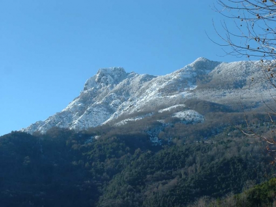
But Corsica is definitely a mountain in the middle of the sea: it culminates at 2710m with Monte Cintu and we can mention twenty other peaks beyond 2000m. Monte Ritondu (2695m), Monte d'Oru (2393m), Monte Rionosu (2343m) or the Alcudina (2136m) to the south. It must be said that more than half of the land is more than 400m above sea level, the average altitude being 560m. Under these conditions, it is clear that roads have to pass through neighboring passes such as Vizzavona, Verghju, Sorba, Verde or Bavedda, which can be blocked by snow from time to time.
The mountain has a great number of lakes, especially in the granitic zone: the mountaineers know Melu, Capitellu, Goria, Bastiani, Crenu and Ninu, which are the most frequented and visited for the quality of the places.
The main rivers are the Golu (84 km) which is the largest, along with the Tavignanu (80 km). But there are also the Fium'orbu, the Travu on the eastern plain, the Taravu, the Gravona and the Liamone; being the main rivers in the south.